Nature trails: Omberg and ice age
⋅ Orchid trail
⋅ Forest loop (Trees and bushes)
⋅ Greta`s garden
Detail maps: Alvastra
⋅ Stocklycke
⋅ Borghamn / North Omberg
Show map on full screen
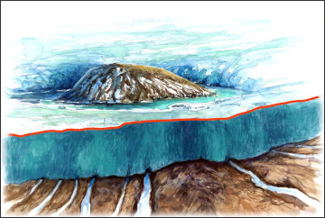
 Illustration: "Gebbe" Björkman
 2,0 / 2,3 km
Do you know what a glacifluvial channel, alluvial cone and a dead ice hole are? Signs at these and other unique finds tell the history of the ice age and its significance to today’s landscape in Omberg. The trail also takes you out to Vätterbranten and the view at Oxbåset and the former shoreline of the Baltic icelocked lake.
The nature trail "Omberg and Ice Age" has been renovated and provided with new signs. Gebbe Björkman made the illustrations, while Sveaskog was responsible for the texts and layout. The inauguration took place on 8 July 2021 15.00 at Stocklycke.
The new "forest loop" replaces the former nature trail "Trees, bushes and forest" with the Hjässatorget as starting point.
 1,8 / 2,2 km
Along the nature trail you can see over 40 different types of trees and shrubs. Many of our native tree species thrive on Omberg and can be found here. During the time of the forest school, many exotic tree species were also introduced on Omberg. Today some of them are real giants. The path leads past the old forest school, the teachers' house and the house of the caretaker (today private houses). Halfway you can make a detour and see Omberg, perhaps Sweden's highest spruce. Furthermore you will also pass a former "mobile" plant school and a cairn from early times of agricultural use of the Omberg.
 2,0 km
Ombergsliden is the realm of orchids. They can be found everywhere: in the limestone bogs, on the pastures and in the spruce forests, and they adorn the landscape. There are also rare and exciting butterflies, mushrooms and snails. Lime, spring water and livestock are the main ingredients of this almost exotic nature. The hiking trail through the reserve offers an excellent start. There you will get to know the different types of nature, and on footbridges you can walk through the limestone moors on dry feet.
Natur reserve Ombergsliden (in swedish)
[ 
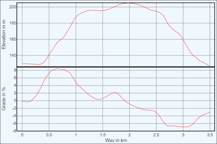
 ] 3,5 km
A private initiative from Borghamn established this nature trail on northern Omberg to Björkens lycka at Vallgatan and Greta's garden between Vallgatan and the former Långebergsvägen. Before the hart park era, there was cultivated land on northern Omberg. The area was called Greta's garden. At least four settlers shared 4-5 acres of open land. When the hart park was erected, all the properties were nationalized and the land here was cultivated with cereals and grass for winter fodder for the red deer. In 1805, the animal park ceased and the land was leased to the tenant of Borg. The last person to use the land was Ernst Björk. The lease ended in 1958 and all the land was planted with fir forest.
The trail starts and ends at Brottsledet, follows parts of Ombergsleden and is marked with signposts and red markings (two red dots). There are explanatory signs at Björkens lycka and Greta's garden. The area has been partially affected by the storm Gudrun. It is not a clear-cut forest.
When ascending the mountain: Do not deviate from the trail at the red sign for the old blue-yellow Marsafällanstigen. Continue on Ombergsleden up the mountain and then turn right towards Vallgatan.

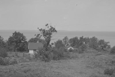
 Forest ranger's cabin Borg 1889
Facilities:
The map section shows all the ways and paths between Borghamn Strand, Brottsledet and Drottning Ommas Borg.
The direct connection between Borghamn Strand and Drottning Ommas Borg past Bockakyrkogården is steep and you have to hold on to ropes. In addition, the path crosses two fence steps, one of which is directly in the slope. Hikers with walking difficulties or with dogs are best advised to use Bockavägen and Sjövägen (i.e. the official route of Marialeden) or alternatively Bockavägen and the lower motion track.
Facilities:
Facilities: